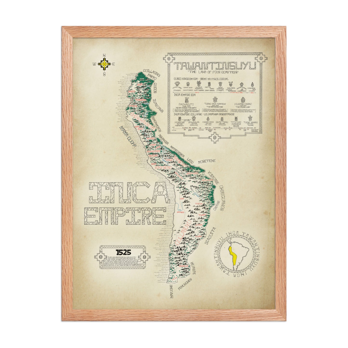
A high-quality print of a hand-drawn map showcasing the Inca Empire at the height of its power. Produced on premium heavyweight paper, it captures fine detail with clarity and offers a lasting, elegant finish which is perfect for framing or display.
Framed option
If you would prefer the poster framed there is an option for a black or red oak frame that comes in both sizes. The material is made from good quality Ayous wood complimenting the poster.
About the Map
The map shows the the Inca empire at the height of its size and power just before the arrival of smallpox and the Spanish. The map stretches from the Maule river in the heart of Chile all the way to the northern territories of Ecuador. Within these borders you will find most of the Andean mountain range along with important towns, provinces and rivers that have been labelled (mostly) in their old Quechua names. Surrounding the empire's borders you will find the numerous tribes and peoples that surrounded the empire.
Looking out of the map you will find the entire history of the Incan rulers. Beginning with the mythical early origins of the Inca moving to the empires golden age and ending with its fall.
For the Empires size and innovation the history of the Inca is that of a quick rise and an even quicker downfall. However it remains the largest known empire to exist in the Americas before the arrival of the western powers and was undoubtedly a fascinating empire that left an incredible mark on history.