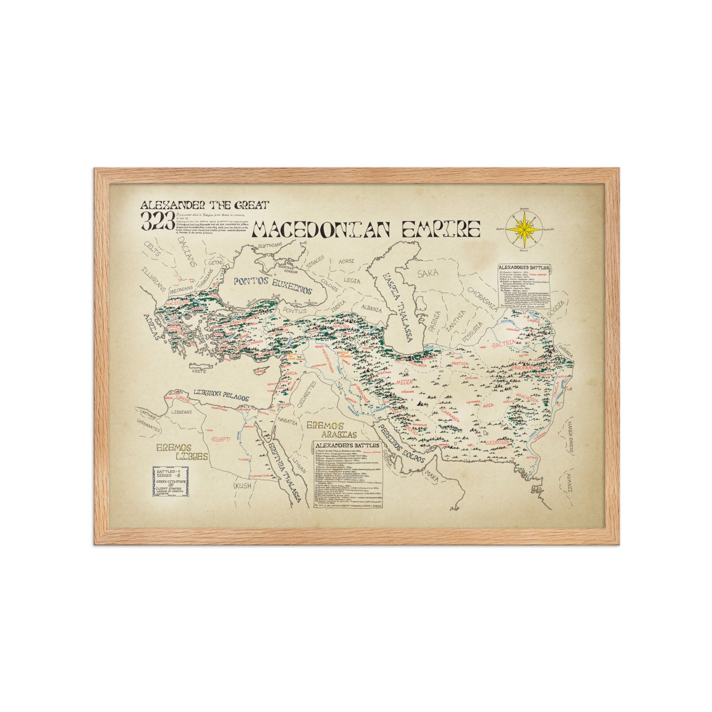
A high-quality print of a hand-drawn map showcasing The Macedonian Empire at the time of Alexander the Greats death. Produced on premium heavyweight paper, it captures fine detail with clarity and offers a lasting, elegant finish — perfect for framing or display.
Framed option
If you would prefer the poster framed there is an option for a black frame that comes in both sizes. The material is made from good quality Ayous wood complimenting the poster.
About the Map
The map shows the Macedonian empire at the height of its size and power just before Alexander's death and untimely demise. The map stretches from the Macedonian heartland in Greece all the way to the Indus River in modern Pakistan. Within these borders you will find important cities, towns, provinces and rivers that have been labelled in their old names. Surrounding the empire's borders you will find seas and deserts labelled along with numerous kingdoms and peoples that surrounded the empire.
Looking closer at the map you will find small markings with a number beside it. Each one represents a military battle or siege that Alexander led. Every one no matter how big or small is dotted across the map and relates to more information listed in the scrolls on the map.
Although the empire was not long-lived, it involves some of the most epic battles, sieges, speeches and storys by one of history's most captivating figures.